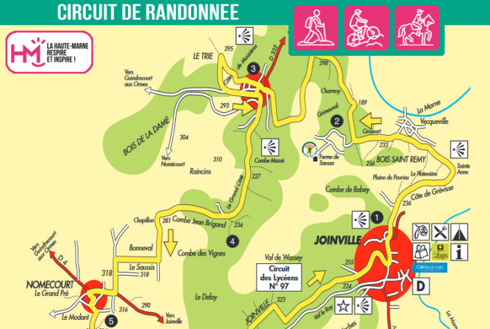
A challenging route in the heart of the Joinville region:
With its 23km and varied terrain, the Vallage circuit is a demanding loop starting out from Joinville, ideal for hardened hikers. The yellow-yellow signposted route alternates between technical climbs, fast descents and long crossings of plateaux and valleys. After climbing the Côte de Vecqueville, the panoramic view over the Marne, Saulx and Rognon valleys sets the tone. The route then heads towards Sommermont, Nomécourt and the Joinville forest, with a succession of woodland paths and farm tracks. The return journey takes in the higher ground, as far as the remains of Château d'En Haut, before a brisk descent to the historic centre of Joinville. Allow around 6 hours' walking or 3 hours on a mountain bike (difficult level). A complete circuit, combining physical effort, variety of terrain and immersion in a remarkable heritage.
Le Vallage - PR N°21
Localisation : JOINVILLE