History, nature and views over the Rognon :
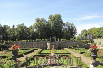
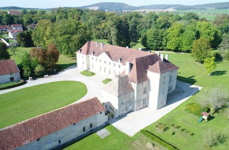
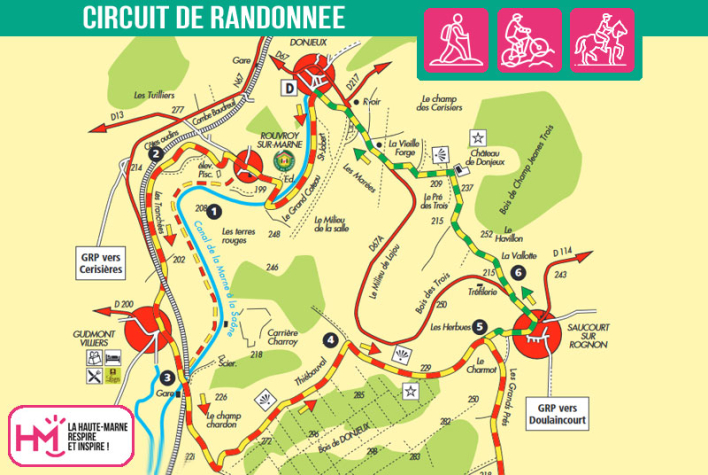
This 14.5km loop from Donjeux is an accessible but fast-paced walk, ideal for regular walkers in search of nature and heritage. Signposted green/yellow and GRP red/yellow, the route follows the Marne and then the canal, passing through the villages of Rouvroy and Gudmont before climbing through woodland to the plateau overlooking the Rognon. Along the way, superb views of the valley alternate with cooler, shadier stretches of woodland. The highlight of the route is the breathtaking view of the Château de Donjeux, an eighteenth-century jewel set on a promontory. The return journey, via the Havillon woods and an old forge, completes this varied walk. Allow around 4 hours on foot or 2 hours 30 minutes on a mountain bike. A complete itinerary, combining moderate effort with historical discovery.
Le château de Donjeux - PR N°38
Localisation : DONJEUX