A loop between forests, springs, cliffs and panoramic views:
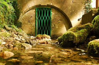
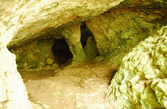
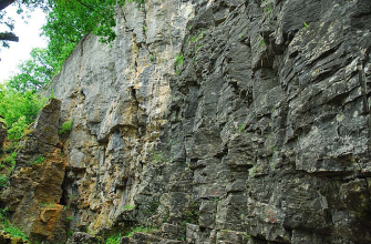
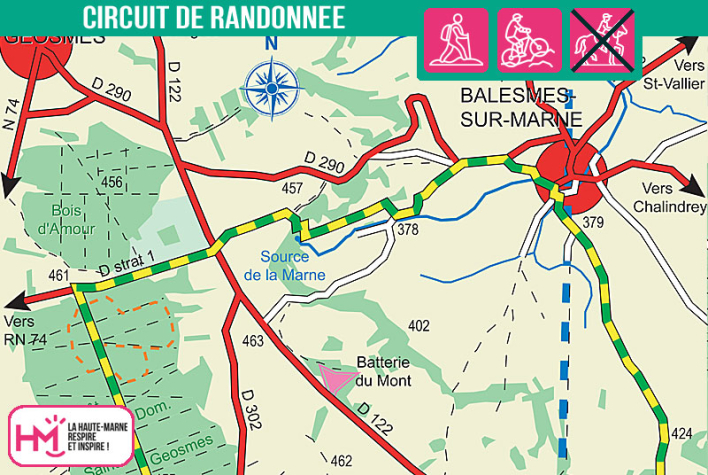
The Source de la Marne hike is a demanding but captivating 15 km loop (approx. 4 hours), which will appeal to curious walkers as much as to families who are a bit sporty. It starts from the Saints-Geosmes fitness trail, and within the first few kilometres, you'll be plunged into the national forest before reaching the heights of Cohons. Between farm tracks, wooded paths and minor roads, the route takes you past some remarkable points of interest: the Cohons "Escargot", the Fontaine Sainte-Marie, then the limestone cliffs of Cohons (with a panoramic view over the south of the Haute-Marne region) and the charming village of Balesmes-sur-Marne. The highlight of the walk? The source of the Marne, nestling in the natural cirque of the Marnotte, and the nearby Sabinus cave. The variety of landscapes, cultural stops and uninterrupted views make this a complete walk, both invigorating and rewarding. It's an ideal way to keep fit while (re)discovering one of the most beautiful sites in the Langres region.
![]()
Walk available on the free Id-Vizit app!
A real personal travel companion, Id-Vizit offers you personalised, fun and interactive tours!
+ More info on Id-Vizit
La source de la Marne - PR N°15
Localisation : BALESMES-SUR-MARNE