A family walk in the heights of Saint-Ciergues:
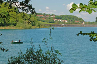
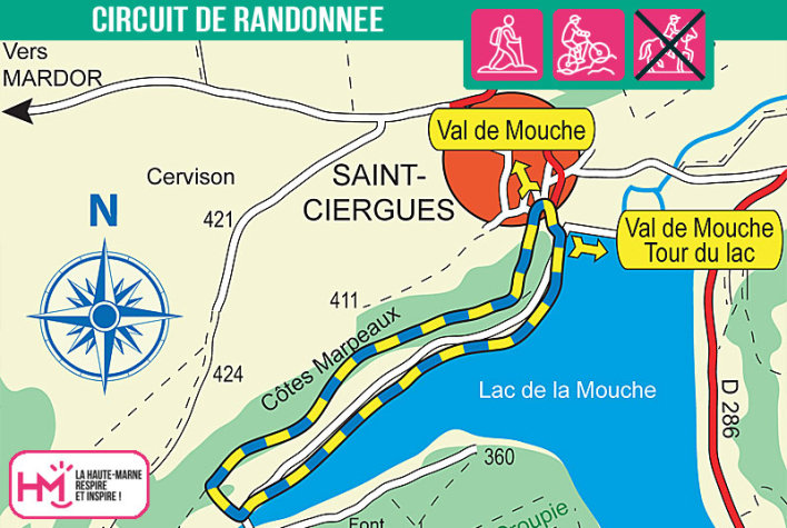
This pretty 4.5 km loop, lasting around 1? hours, is perfect for a family outing between lake, undergrowth and viewpoints. From the village square in Saint-Ciergues, take the short, shady path down to Lac de la Mouche along the water's edge. The atmosphere is peaceful, ideal for observing the reflections of the sky in the lake. After a well-placed picnic area, the path climbs gently through the "Côtes Marpeaux" to the famous Saint-Ciergues rocks. The climb is gradual and easy, and there is a fine panoramic view from the top. The rest of the trail descends along a pleasant grassy path to the heart of the village. Stop off at the listed church before returning to your starting point. This is an accessible trail that combines nature and heritage, for a great day out with the kids!
Les roches - PR N°136
Localisation : SAINT-CIERGUES