An undulating route through forests, valleys and heritage sites:
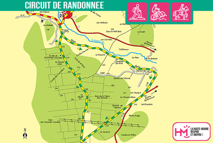
Leaving from Doulaincourt, this 14.5km route offers a dynamic hike, perfectly suited to regular walkers looking for variety. Signposted green-yellow and yellow-red, the route starts on the Marne-Rognon GRP, crosses the bridge over the Rognon and runs alongside the old "Coco" railway line, a vestige of local history. The route then enters a wilder environment, alternating between river banks, wooded paths and old farm tracks. After the source of the Dhuit, a natural spring, the climb via the old Vignory path and the deep ravines of Saint-Brice puts the legs to the test. The return journey over the heights of the valley offers a beautiful view of the villages of Bettaincourt and Roches. Around 3? hours of walking for a loop that balances effort, forest nature and evidence of Haute-Marne's railway and rural past.
Les Essarts - PR N°53
Localisation : DOULAINCOURT-SAUCOURT