A dynamic route through woods, valleys and villages:
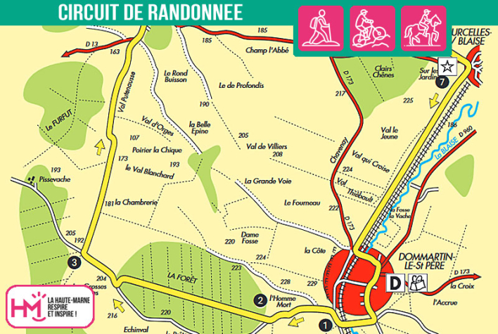
With its 17km from Dommartin-le-Saint-Père, the Chavenay circuit offers a complete and sustained loop, ideal for sporty walkers. The route alternates between forest crossings, gradual climbs, technical descents and long sections of open terrain. You'll cross the River Blaise, climb through woodland to the Combe de Dommartin, pass through farmland to Mertrud and then plunge back into the woods to Courcelles-sur-Blaise. A wide variety of landscapes accompany this rhythmic loop, between historical relics (commemorative cross, old mills) and natural passages (hedgerows, wicker fields, Roman road). Marked in yellow, this circuit requires endurance and regularity over a 4h30 walk (2h30 on a mountain bike). A great opportunity to push your limits on a varied terrain in the heart of the Haute-Marne.
Chavenay - PR N°54
Localisation : DOMMARTIN-LE-SAINT-PERE


