Between military heritage and wild nature :
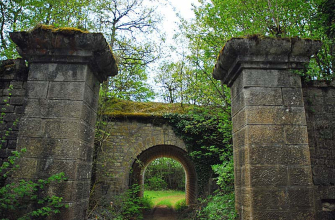
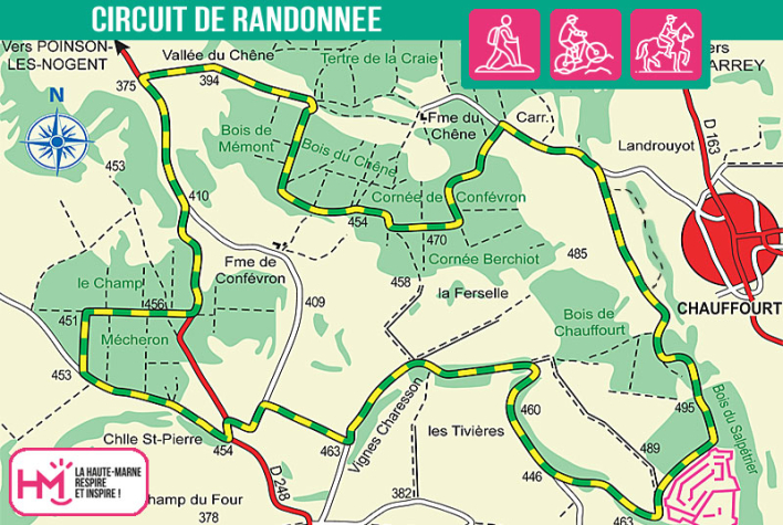
This is a characterful 14km walk (approx. 3.5 hours) that will appeal to regular walkers and sporty families alike. The walk starts from the picnic area above Chauffourt, and very soon the path leads deep into the forest to the Dampierre fort, an impressive vestige of Langres' defensive system. After passing under fir trees and along the "Tivières", you'll come across the paraglider take-off site, then walk through fields and woods.
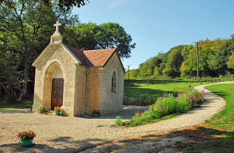
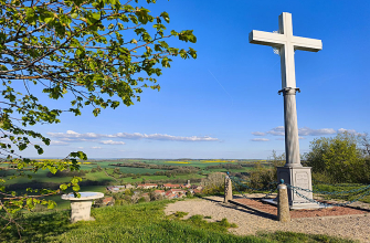
The route is a mixture of forest paths, minor roads and hilly stretches, with a few welcome stops such as the chapel of Saint-Pierre, the statue of the Virgin "Notre-Dame du Chêne" and its superb panorama. The effort is rewarded by the variety of scenery and the peace and quiet of this little-travelled area. It's the perfect walk for those who want to immerse themselves in nature, while discovering a rich historical and spiritual heritage.
La Jaunotte - PR N°5
Localisation : DAMPIERRE