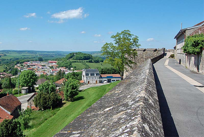
On the terrace of the Tour du Petit Sault, the western rampart offers an orientation table with a view of the Marne valley and the Plateau de Langres.
It's as if the terrace of the Tour du Petit Sault were the prow of a ship surfing the waves of a vanished sea. The 210° panorama reveals the Bonnelle valley, which eventually merges with the Marne valley just a stone's throw away. The former retains a strong rural character; as it flows northwards, it contributes, along with the latter, to the chiselling of the Langrois spur, giving it its finger-like shape. The suburb of Buzon seems to cling to the slopes of the plateau, while Brevoines nestles along the river. Each resembles a village, its buildings set against a green backdrop that has changed little over the centuries.
Beyond the valley begins "la Montagne", the local name for the plateau stretching south-west from Langres towards Burgundy. Peaking at 523 metres, these hilly, often wooded stretches form the "roof" of the Haute-Marne.
The Fourches hill was the site of hangings until the Revolution; a chapel dedicated to Notre-Dame de la Délivrance was built on the summit in 1873.
On the horizon, on the heights overlooking the valleys, you can still make out the lurking, massed silhouette of a few detached forts making up the protective perimeter built between 1874 and 1885 as part of the Séré de Rivières defensive system. From south to north: Fort de la Bonnelle (1869-1885), Fort de la Pointe de Diamant (1874-1877), Fort de Saint-Menge (1874-1881).
Panorama Ouest des remparts de Langres