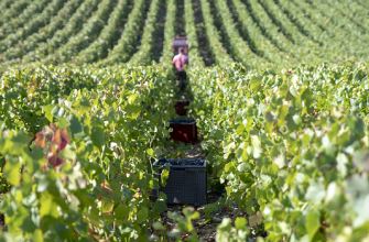
A demanding route through vineyards and valleys:
Leaving from Rizaucourt, this 15.5km loop offers a sustained hike through a wine-growing landscape shaped by hard work and tradition. The route alternates between gradual climbs, balconies above the vines and woodland paths dotted with uninterrupted views over the Haut-Marnais countryside. The moderate but constant gradient makes this an ideal route for seasoned walkers looking for endurance and a variety of terrain. Along the way, the route runs alongside the Sentier Historique de Jeanne d'Arc (GR703) and passes through a number of villages that are emblematic of the Champagne Route, including Buchey, Argentolles and Biernes. It's a great way to combine physical exertion with winegrowing heritage. At the end of the route, a final climb above the vineyards takes you back to Rizaucourt. Signposted green-blue and white-red, this 4.5-hour route offers a varied and rhythmic terrain, ideal for training while enjoying the authenticity of the Champagne countryside.
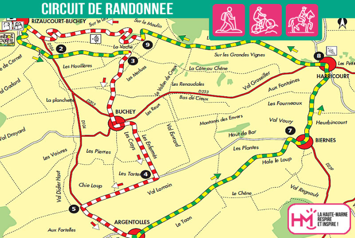
Les coteaux de Champagne - PR N°14
Localisation : RIZAUCOURT-BUCHEY