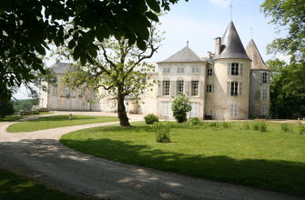
Reynel is the perfect place for a leisurely stroll in the heart of nature:
From the fortified gateway at Reynel, set off on a 12km loop combining wild nature, local history and rolling countryside. The trail begins in a deep, canyon-like valley, where you walk along an ancient stream bed strewn with pebbles and fossils. This is a more technical section that will appeal to experienced walkers, but is still accessible to good amateur hikers. The rest of the route skirts the peaceful Benoîtevaux pond, then climbs steadily up to the plateau. A steeper descent leads to the old mills on the ruisseau des Battants, remnants of the local craft industry's past. Along the way, there are shady picnic areas and an old wash-house at the foot of Reynel castle. This varied route takes around 3 hours to complete, and is ideal for those looking for an active yet contemplative walk in the heart of the Haute-Marne countryside.
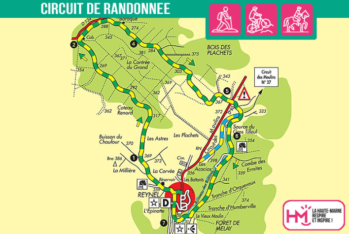
La contrèe du Grond - PR N°26
Localisation : REYNEL