A loop between forest, views and local memory:
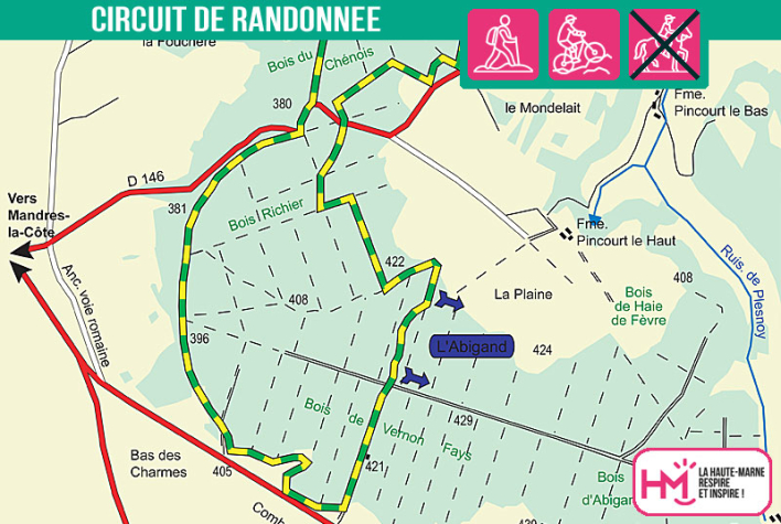
Starting from the car park at the Nogent fitness trail, this 12km circuit takes you through a hilly forest landscape, ideal for an active but accessible hike. The route skirts the Vernon-Fays and Chênois woods before reaching a hillside overlooking the Etang du Vau, with fine views of the Cul-de-Sac rocks. This balcony section is a little technical, but is still passable with good footwear. In the forest, the path crosses slices and valleys before reaching the Croix du Maquis de Pincourt, a poignant reminder of the local Resistance. The return journey is gentler and takes you back down to the starting point. Marked out in green and yellow, this varied trail (3-hour walk) will delight both regular walkers and lovers of history and nature, looking for a balanced mix of effort, contemplation and remembrance.
Once you've completed the route, we invite you to come and discover Nogent and its cutlery...
Le cul de sac - PR N°67
Localisation : NOGENT


