Nature, history and views:
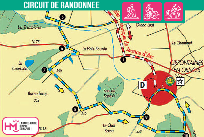
Leaving from Cirfontaines-en-Ornois, this 10km trail offers a wonderful blend of historical heritage and natural beauty. Signposted in blue and yellow and dotted with the signs of the Joan of Arc trail (GR703), the route follows part of the route taken by the famous heroine in 1429. Accessible to regular walkers, it offers a varied terrain, with long wooded sections, gradual climbs and gentle descents. From the heights of the Glandenoie forest or the plateau overlooking the Orge valley, the views of the villages and countryside are superb. The route also skirts a pond and a wood, and passes close to the Cirfontaines aerial radar station, a surprisingly modern landmark in this rural setting. There is a variant route that allows you to return directly to shorten the journey. Allow around 2? hours on foot for this walk that combines accessible effort with a wealth of history.
Variations:
- Variant 1, without the northern part of the route: 7 km with a 40 m ascent.
- Variant 2, without the northern and southern parts of the route: 5.5 km with a difference in altitude of 25 m.
La vallée de l'Orge - PR N°115
Localisation : CIRFONTAINES-EN-ORNOIS


