GR de Pays Marie Calves - N°112

Localisation : BOLOGNE

Download the route

GR de Pays Marie Calves - N°112

  • Loop route

  • Distance

    77 Km

  • Height difference

    1220 m

  • Foot : Difficult |
  • Equestrian : Difficult |
  • Mountain biking : Difficult |
Departure and arrival : BOLOGNE

Markup

Blue / Yellow (PR up to 10 km) Green / Yellow (PR from 11 to 18 km) Yellow / Red (Regional GR)

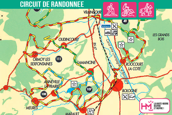
The Marie Calvès trail is a 74km loop linking 17 villages in the Bologne-Vignory-Froncles area. It can be done on foot, horseback or mountain bike over one or more days, depending on your level of ability.

Practical information

Maintenance

  • Servicing : Communauté de Communes de l'Agglomération de Chaumont

  • Markup : FFRandonnée 52 - Communauté de Communes de l'Agglomération de Chaumont

Contact

  • Loop route

  • Distance

    77 Km

  • Height difference

    1220 m

Tailor-made getaways

Discover Haute-Marne